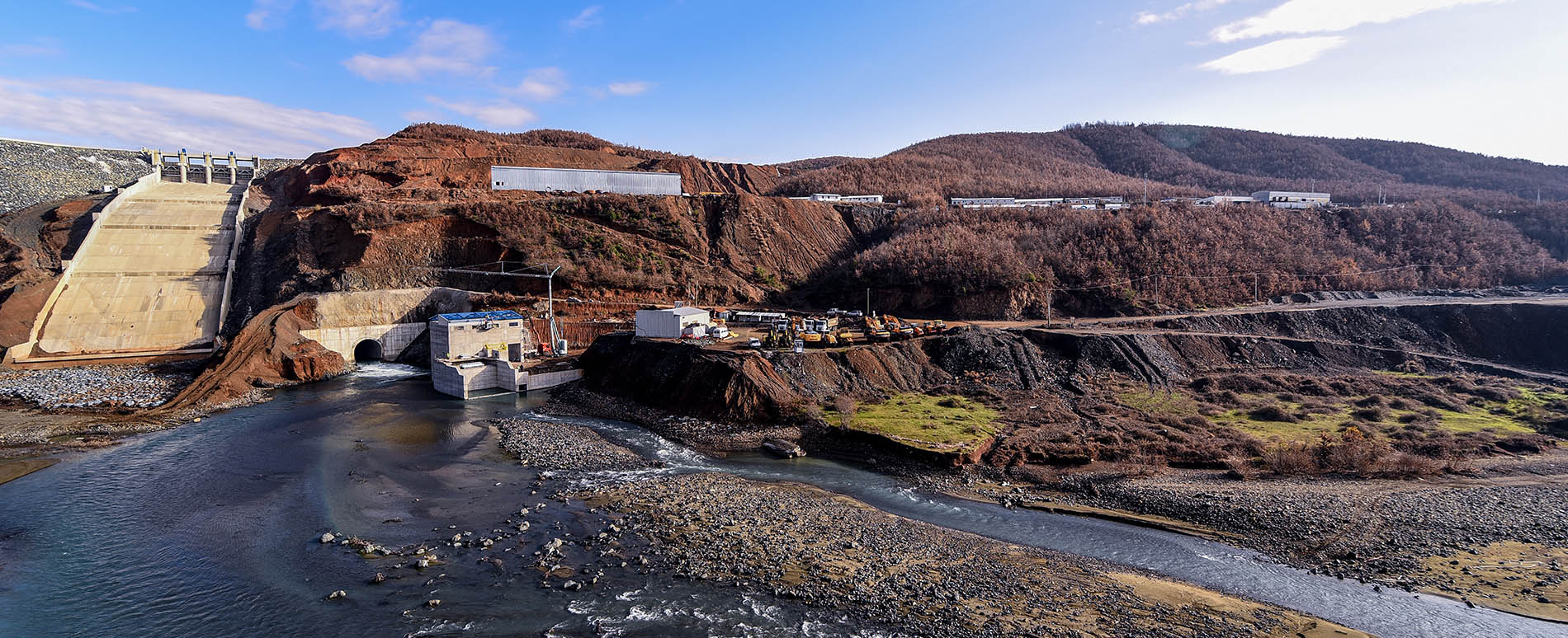
The hydrographic system of the Fani Hydropower Project consists of Fani i Madh in the upper and middle basins with its main tributaries of Kryeziu, Qafa e Malit, Micajt, Sharit, Lumi i Zi, Kimza, Shatina, Guri i Kuq, Shperdhaza, Dibri and Fani i Vogel river in the middle basin with its tributaries of Zmeja e Vogel and Zmeja e Madhe.
These rivers confluence together 10 km near Shkoret village, in Orosh to form Fani i Bashkuar river which in its lower basin is joined by the tributaries of Reja e Veles and Rubiku. The river joins the Mati river in the lower basin, near Milot bridge. The Fani i Madh river which has its source from Qafa e Malit, has a drainage basin of 542 km2 and a length of 94.4 km while the Fani i Vogel river outsources from Qafa e Kumbulles and has a drainage basin of 415 km2 and length of 60 km.
In terms of topography, the rivers pass through altitudes ranging from 1397 m to 20 m.
Three gauging stations are used for the collection of the hydrological data and listed as the Breg, Bukmir and Nderfan stations.
In terms of climate, the upper basin is characterized by humid continental meanwhile the rest of the valley shows a Mediterranean climate with hot and dry summers and humid winters. The average annual rainfalls for this region fluctuate at 1600 mm in an extremely varying trend, with 80% of the rainfalls during October –May period.
The river has particular features in relation to the kind of topography, climate and soil.
The vegetation in the surrounding area ranges from typical Mediterranean macchia (maquis shrub land) vegetation to oak forests, with the highlands characterized of vast forests of black pine, beech and fir.
In terms of the geology , the district of Mirdita is part of zones with medium storage coefficient. This is due to the distribution of rocks with different infiltration capacities and non-uniformly developed fissures. In this region, igneous intrusive and extrusive rocks predominate. The discharges from the hydro geological test boreholes vary greatly depending on the fissure parameters of the rocks. The tectonic regions are distinguished for abundant water resources.
